MountainsMap® –
3D analysis software for evaluating measurement data
With MountainsMap®, you can evaluate 3D measurement data from your smartWLI surface metrology quickly, in compliance with standards, and with visually compelling results. The software is a universal tool for visualizing, analyzing, and documenting measurement data – from contour analysis to ISO-compliant roughness evaluation.
MountainsMap® Imaging Topography
| Basismodul | Basismodul für die Darstellung und Bewertung von 3D Daten und erforderlich für den Einsatz aller optionalen Module |
| Workflow | interactive macro creation |
| Selection of macros in smartVIS3D for automated measurement and evaluation processes | |
| Results form the basis for further interactive assessments | |
| Functionality | Automated visualization and evaluation of 3D data, including topography, image data, and quality information |
| Merging of individual measurements using positioning data and/or overlapping areas | |
| Selection and evaluation of profile sections | |
| Selection and evaluation of profile sectionsCalculation of 2D and 3D roughness parameters and basic functions for the evaluation of microgeometries | |
| Batch process analysis of many 3D data sets |
Seamless collaboration with smartVIS3D
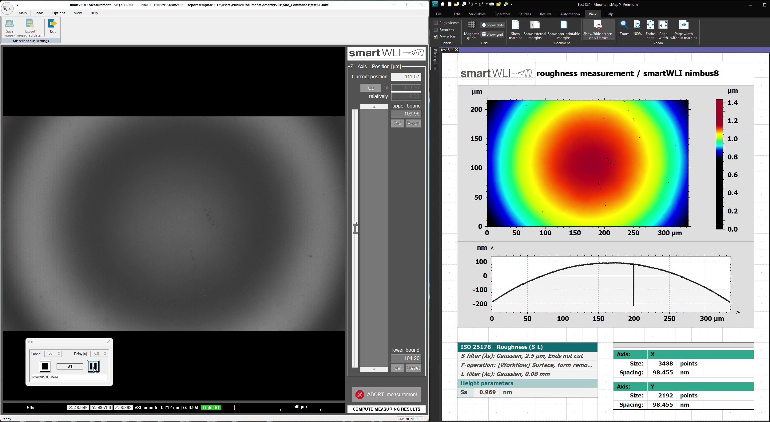
MountainsMap® perfectly complements the scanning software smartVIS3D. After completing the scanning process, MountainsMap® automatically takes over the evaluation of the acquired data. Predefined macros enable application-specific assessments and ensure reproducible results with minimal time investment.
With predefined macros, application-specific evaluations can be performed quickly and reproducibly – ideal for efficient workflows.
Efficient resource management and shared data processing with smartVIS3D enable double throughput, ensuring optimal resource utilization.
Powerful features for maximum impact
- Contour analysis & profile evaluation
-
Statistical particle and structure analysis
-
Geometric measurement data & tolerance verification
-
ISO-compliant 2D and 3D roughness analysis
-
3D data alignment and comparison (e.g., CAD models, before/after measurements)
-
Filtering & stitching/patching to combine large measurement areas
-
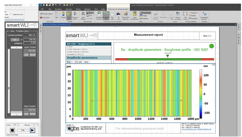
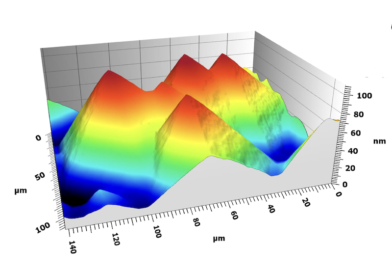
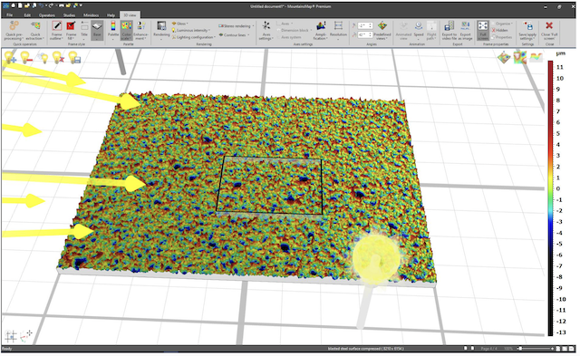
Versatile visualization options (2D/3D views, contour lines, color palettes, animations, stereo rendering)
Visualization options
- 2D and 3D display
-
Contour lines and diverse color palettes
-
Various lighting models, specular highlights, and stereo rendering
-
Animated surface movements and export of animations
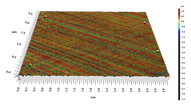
Profile extraction:
-
Interactive selection of one or multiple profile lines
-
2D and 3D display of profile lines
-
Automatic updating of subsequent results
Individual workflows and automation
MountainsMap® works on a document-based system and allows you to customize each processing path individually and save it as a template. Raw data remains unchanged and can be replaced at any time—ideal for validating the same processing pipeline with different input data. New in version 8 is simultaneous data processing:
Multiple datasets can be processed simultaneously, significantly increasing throughput. For recurring tasks, batch processing is available, allowing saved templates to be applied to any number of datasets. Results and reports can be conveniently exported as PDF, Excel, or in other formats.

Software packages and application areas
MountainsMap® is modular and can be precisely tailored to the specific task. Besides the base package, numerous extension modules are available.
This flexibility makes the software an ideal tool for a wide range of applications:
-
Topographic analysis of micro- and nanostructures
-
Statistical evaluation of porosity or honeycomb structures
-
Wear and structural analyses in research and quality control
-
Comparison of measurement data with CAD models
Whether you analyze surfaces in the automotive industry, medical technology, or precision manufacturing — you select exactly the modules you need, and MountainsMap® grows with your projects as required.

Automotive
- Optional module: extends the functionality of MountainsMap® Imaging Topography
- Functionality extension: calculation of functional parameters for the automotive industry
Advanced Profile
- Optional module: extends the functionality of MountainsMap® Imaging Topography
- Functionality extension: advanced filtering options for spectral and fractal analysis of profiles
- Statistical analysis of profiles


Contour
- Optional module: extends the functionality of MountainsMap® Imaging Topography
- Functionality extension: dimensional analysis of profiles and contours
Advanced Contour
- Optional module: extends the functionality of MountainsMap® Imaging Topography
- Includes MM 2005
- Functionality extension: advanced dimensional evaluation options for profiles and contours
- Import of dxf files and comparison with CAD data
Advanced Topography
- Optional module: extends the functionality of MountainsMap® Imaging Topography
- Functionality extension: advanced filter functions
- Volume, spatial, hybrid, and flatness parameters, isotropy and periodicity evaluations, peak evaluation, and fractal evaluations


Fourier and Wavelets
- Optional module: extends the functionality of MountainsMap® Imaging Topography
- Functionality extension: FFT-based spectral analysis options
- Wavelet, spectral, and multiscale analysis of surface textures
Colocalization
- Optional module: extends the functionality of MountainsMap® Imaging Topography
- Functionality extension: alignment of data sets with large overlapping but non-identical measurement positions


4D Series
- Optional module: extends the functionality of MountainsMap® Imaging Topography
- Functionality extension: visualization of surface changes (timelines) from measurement series of the same measurement object
Particle analysis
- Optional module: extends the functionality of MountainsMap® Imaging Topography
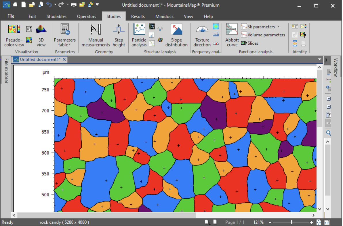
- Functionality extension: detection and classification of local surface structures can be used for particles, pores, grains, peaks, etc.
- Threshold, watershed, edge, and spherical detection of surface structures
- Classification of volume, area, height, depth, position, distance, shape, and orientation…
Scale Sensitive Analysis
- Optional module: extends the functionality of MountainsMap® Imaging Topography
- Functionality extension: method for analyzing geometric properties of surface textures and their scale derivatives (complexities), including length scale and area scale method
Lens Analysis
- Optional module: extends the functionality of MountainsMap® Imaging Topography
- Functionality extension: methods for evaluating aspheric surfaces and profiles


MountainsMap module Thickness Analysis MM 2016
- Optional module: extends the functionality of MountainsMap® Imaging Topography
- Functionality extension: methods for evaluating the layer thickness of multi-layer data sets
MountainsMap Addon honing structure analysis AO 1001
- Methods for analyzing geometric surface properties of cylinder bores
- Results: Honing angle, ascending/descending grooves, ascending/descending structures, cross/closed structures
- Software module for MountainsMap® Imaging Topography, requires MountainsMap® modules Fourier and Wavelets

Your benefits at a glance
With MountainsMap®, you get a professional, standards-compliant analysis platform that integrates seamlessly into your measurement processes. Benefit from shorter analysis times, less manual rework, and clear visualization for documentation, reporting, and customer communication.
shorter analysis times
less manual rework
clear visualization for documentation, reports & customer communication
Try the free trial and sample measurement now
Download
MountainsMap® is available as a 30-day free trial download from the website www.digitalsurf.com.
GBS offers the first test measurement generally free of charge!
You can test MountainsMap using the data from your sample!
Configuration
Test your configuration to determine the necessary evaluation modules!
The trial version can be configured with or without add-on modules.
This way, you avoid unnecessary costs.
Trial periods are available anytime – even if you have already purchased the base package and are considering a software upgrade.
Contact
If you have any questions about the MountainsMap® trial version, please feel free to contact us anytime:
